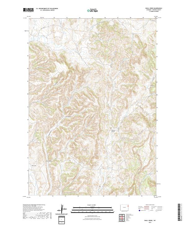
2021 Map of Skull Creek
USGS Topo · Published 2021About this map
Skull Creek Canyon and a series of rugged draws define this landscape in eastern Wyoming, where the drainage systems of Skull Cr and Oil Creek cut through the high plains. The map reveals a remote ranching and resource area navigated by unimproved routes like Oil Creek Rd and Skull Creek Rd. The topography is characterized by steep-walled incisions such as Bertha Canyon, Berry Canyon, and Love Canyon, which create a complex network of ridges and gulches. Named water sources like Grand Stump Spring and seasonal drainages including Sand Creek and West Plum Creek provide the necessary hydrology for this arid environment. This 2021 digital survey documents the modern land divisions and access roads used to navigate the varied elevations of Weston County.
Find a feature on this map
24 named features on this map. Tap any name to fly to it.
Don’t see what you’re looking for? This feature index may not catch every label — zoom into the map to look around manually.
Map Details
Editions of this 2021 Skull Creek Map
This is the sole edition of this map. No revisions or reprints were ever made.
Other maps of this area

1898 · Sundance
USGS Topo · 1:125,000

1899 · Newcastle
USGS Topo · 1:125,000

1901 · Newcastle
USGS Topo · 1:125,000

1902 · Sundance
USGS Topo · 1:125,000

1954 · Gillette
USGS Topo · 1:250,000

1955 · Newcastle
USGS Topo · 1:250,000

1955 · Gillette
USGS Topo · 1:250,000

1958 · Gillette
USGS Topo · 1:250,000

1958 · Newcastle
USGS Topo · 1:250,000
1958 · Four Corners
USGS Topo · 1:62,500