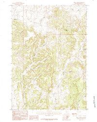
1984 Map of Skull Creek
USGS Topo · Published 1984About this map
Skull Creek and its many tributary drainages carve through this corner of Weston County, Wyoming, during a period of active resource exploration in the mid-1980s. The landscape is defined by an intricate network of named ravines, including Love Canyon, Bolden Canyon, and the curiously titled Watermelon Canyon. These features demonstrate how localized naming conventions often reflected the families or specific events of the early ranching and homesteading era in the high plains.
Find a feature on this map
15 named features on this map. Tap any name to fly to it.
Don’t see what you’re looking for? This feature index may not catch every label — zoom into the map to look around manually.
Map Details
Editions of this 1984 Skull Creek Map
This is the sole edition of this map. No revisions or reprints were ever made.
Other maps of this area

1898 · Sundance
USGS Topo · 1:125,000

1899 · Newcastle
USGS Topo · 1:125,000

1901 · Newcastle
USGS Topo · 1:125,000

1902 · Sundance
USGS Topo · 1:125,000

1954 · Gillette
USGS Topo · 1:250,000

1955 · Newcastle
USGS Topo · 1:250,000

1955 · Gillette
USGS Topo · 1:250,000

1958 · Gillette
USGS Topo · 1:250,000

1958 · Newcastle
USGS Topo · 1:250,000
1958 · Four Corners
USGS Topo · 1:62,500