
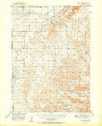
1950 Map of Skunk Lake
USGS Topo · Published 1950About this map
The Niobrara River carves through the northern reaches of the High Plains on this mid-century survey of the Box Butte and Sharp regions. The landscape is defined by its vast drainage network, where Box Butte Creek flows toward the river, and a series of wind-carved depressions in the south hold a chain of alkaline and freshwater bodies including Skunk Lake, Albrecht Lake, and Dillings Lake.
Find a feature on this map
31 named features on this map. Tap any name to fly to it.
Don’t see what you’re looking for? This feature index may not catch every label — zoom into the map to look around manually.
Map Details
Editions of this 1950 Skunk Lake Map
2 editions found
Other maps of this area

1946 · Berea Creek East
USGS Topo · 1:24,000

1947 · Box Butte NE
USGS Topo · 1:24,000

1947 · Box Butte
USGS Topo · 1:24,000

1948 · Berea Creek East
USGS Topo · 1:24,000

1948 · Antioch
USGS Topo · 1:62,500

1948 · Lakeside
USGS Topo · 1:62,500

1948 · Twin Lakes
USGS Topo · 1:62,500

1949 · Box Butte NE
USGS Topo · 1:24,000

1949 · Antioch
USGS Topo · 1:62,500

1949 · Box Butte
USGS Topo · 1:24,000