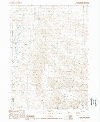
1989 Map of Skunk Lake SW
USGS Topo · Published 1989About this map
Family-named ranching operations anchor this High Plains landscape along the border of Box Butte and Sheridan counties. The map captures a quintessential Western Nebraska cattle-country layout, where sprawling landholdings like the K Messersmith Ranch and S Messersmith Ranch are defined by the presence of vital water sources and isolated social hubs. The drainage of Box Butte Creek meanders through the western portion of the quadrangle, providing a seasonal lifeline in an otherwise arid region. In the southeastern corner, the Twin Lakes Ranch and the nearby Twin Lakes stand as prominent landmarks. This era of rural education is still evidenced by the presence of School No 100, highlighting the dispersed yet organized settlement pattern of the Nebraska Panhandle in the late 1980s.
Find a feature on this map
7 named features on this map. Tap any name to fly to it.
Don’t see what you’re looking for? This feature index may not catch every label — zoom into the map to look around manually.
Map Details
Editions of this 1989 Skunk Lake SW Map
This is the sole edition of this map. No revisions or reprints were ever made.
Other maps of this area

1946 · Berea Creek East
USGS Topo · 1:24,000

1947 · Box Butte NE
USGS Topo · 1:24,000

1947 · Box Butte
USGS Topo · 1:24,000

1948 · Berea Creek East
USGS Topo · 1:24,000

1948 · Antioch
USGS Topo · 1:62,500

1949 · Box Butte NE
USGS Topo · 1:24,000

1949 · Antioch
USGS Topo · 1:62,500

1949 · Box Butte
USGS Topo · 1:24,000

1950 · Skunk Lake
USGS Topo · 1:62,500

1955 · Alliance
USGS Topo · 1:250,000