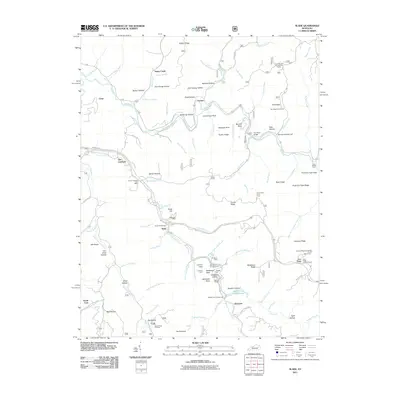
2011 Map of Slade
USGS Topo · Published 2011About this map
Red River and its multiple forks carve through the landscape of eastern Kentucky, defining the layout of settlements like Slade and Glencairn. The area is characterized by an intricate network of hollows and ridges, including Bowen Hollow and Tunnel Ridge, which have historically dictated the placement of roads and transport. A notable engineering feature is the Nada Tunnel, which provides access through the high terrain to the north of the river.
Find a feature on this map
111 named features on this map. Tap any name to fly to it.
Don’t see what you’re looking for? This feature index may not catch every label — zoom into the map to look around manually.
Map Details
Editions of this 2011 Slade Map
This is the sole edition of this map. No revisions or reprints were ever made.
Other maps of this area

1892 · Beattyville
USGS Topo · 1:125,000

1951 · Pomeroyton
USGS Topo · 1:24,000

1952 · Scranton
USGS Topo · 1:24,000

1952 · Frenchburg
USGS Topo · 1:24,000

1952 · Stanton
USGS Topo · 1:24,000

1952 · Means
USGS Topo · 1:24,000

1952 · Slade
USGS Topo · 1:24,000

1952 · Cobhill
USGS Topo · 1:24,000
1952 · Campton
USGS Topo · 1:24,000

1953 · Zachariah
USGS Topo · 1:24,000