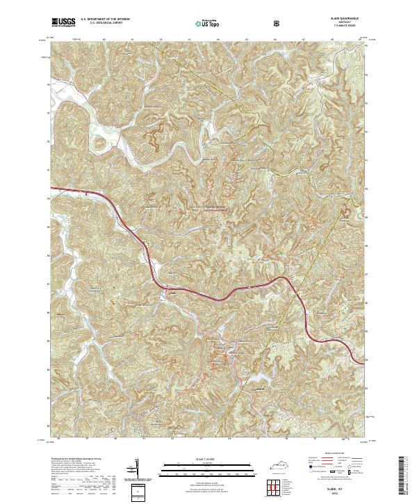
2022 Map of Slade
USGS Topo · Published 2022About this map
Daniel Boone National Forest provides the backdrop for this study of the Red River Gorge area, where the Red Wild and Scenic River and Middle Fork Red River carve through the geological formations of Powell and Wolfe Counties. The settlement of Slade serves as a central point for a landscape defined by its high density of natural stone spans, including Nada Arches, Double Arch, and the Slade Twin Arches. The map documents a complex network of established hiking paths such as the Sheltowee Trace Trl and Rough Trl, which navigate the narrow spines of Pinch-Em Tight Ridge and Auxier Ridge. This 2022 survey captures the preservation of the gorge's unique character, from the secluded John Knox Hollow to the prominent heights of Courthouse Rock, illustrating how modern recreation corridors follow the ancient contours of the Kentucky landscape.
Find a feature on this map
112 named features on this map. Tap any name to fly to it.
Don’t see what you’re looking for? This feature index may not catch every label — zoom into the map to look around manually.
Map Details
Editions of this 2022 Slade Map
This is the sole edition of this map. No revisions or reprints were ever made.
Other maps of this area

1892 · Beattyville
USGS Topo · 1:125,000

1951 · Pomeroyton
USGS Topo · 1:24,000

1952 · Scranton
USGS Topo · 1:24,000

1952 · Frenchburg
USGS Topo · 1:24,000

1952 · Stanton
USGS Topo · 1:24,000

1952 · Means
USGS Topo · 1:24,000

1952 · Slade
USGS Topo · 1:24,000

1952 · Cobhill
USGS Topo · 1:24,000
1952 · Campton
USGS Topo · 1:24,000

1953 · Zachariah
USGS Topo · 1:24,000