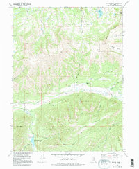
1972 Map of Slader Basin
USGS Topo · Published 1995About this map
Wasatch National Forest dominates this high-altitude landscape in northern Utah, where the headwaters of the Weber River gather in a complex network of alpine basins and ridges. The 1972 survey records a landscape shaped by seasonal grazing and recreation, centered on the Thousand Peaks Ranch and the Smith and Morehouse Reservoir. Geologic and industrial history is marked by a Mill near Mill Fork and the prominent Slader Ridge, while the northern portion of the quadrangle is defined by peaks like Humpy Peak and deep glacial cirques including Moffit Basin and Silks Basin. This era shows the transition of the forest toward modernized resource management and recreation, evidenced by the established Campground near the confluence of Smith and Morehouse Creek and Bear Trap Creek. Notable water bodies like Boyer Lake and Blue Lake sit tucked beneath Humpy Ridge, providing a clear record of the area's hydrology before later development or environmental shifts.
Find a feature on this map
29 named features on this map. Tap any name to fly to it.
Don’t see what you’re looking for? This feature index may not catch every label — zoom into the map to look around manually.
Map Details
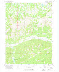
Editions of this 1972 Slader Basin Map
2 editions found
Other maps of this area

1885 · Salt Lake
USGS Topo · 1:250,000

1885 · Uinta
USGS Topo · 1:250,000

1900 · Coalville
USGS Topo · 1:125,000

1901 · Hayden Peak
USGS Topo · 1:125,000

1903 · Hayden Peak
USGS Topo · 1:125,000

1903 · Coalville
USGS Topo · 1:125,000

1954 · Salt Lake City
USGS Topo · 1:250,000

1958 · Salt Lake City
USGS Topo · 1:250,000

1960 · Salt Lake City
USGS Topo · 1:250,000
1967 · Upton
USGS Topo · 1:24,000