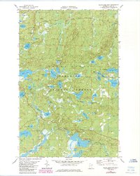
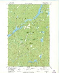
1981 Map of Slate Lake East
USGS Topo · Published 1985About this map
The Superior National Forest dominates this northern Minnesota landscape, where a dense network of lakes and waterways defines the movement through the wilderness. The Snake River and Isabella River wind through the terrain, connecting large bodies of water like Slate Lake and Gunsten Lake. This 1980s-era documentation reflects the established recreational and forestry infrastructure of the region, noting established sites such as Camp Buckskin and the McDougal Lakes Campground. Industrial activity is localized to scattered Gravel Pit locations along the Tomahawk Road, while the vast interior is accessible primarily via the Winter Road and various Winter Trails. Local topography is highlighted by Jack Pine Mountain, providing a distinct landmark amidst the glacial lakes and bogs including Leatherleaf Lake and Sphagnum Creek.
Find a feature on this map
57 named features on this map. Tap any name to fly to it.
Don’t see what you’re looking for? This feature index may not catch every label — zoom into the map to look around manually.
Map Details
Editions of this 1981 Slate Lake East Map
2 editions found
Other maps of this area

1954 · Greenwood Lake
USGS Topo · 1:62,500

1954 · Two Harbors
USGS Topo · 1:250,000

1955 · Isabella
USGS Topo · 1:62,500

1957 · Two Harbors
USGS Topo · 1:250,000

1957 · Gabbro Lake
USGS Topo · 1:62,500

1958 · Two Harbors
USGS Topo · 1:250,000

1964 · Two Harbors
USGS Topo · 1:250,000
1981 · Gabbro Lake
USGS Topo · 1:24,000
1981 · Slate Lake West
USGS Topo · 1:24,000
1981 · Bogberry Lake
USGS Topo · 1:24,000