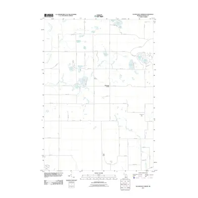
2011 Map of Slaybaugh Corner
USGS Topo · Published 2011About this map
Slaybaugh Corner sits at the center of this rural Michigan landscape, where a dense network of sectional roads like 9 Mile Rd and 175th Ave defines the movement across Osceola County. The area is characterized by a high concentration of glacial kettle lakes, ranging from the central Todd Lake and Lincoln Lake to the clustered Wells Lake, Bass Lake, and Penasa Lake in the north. This 2011 survey documents a mix of agricultural utility and localized industry, notably the Cedar Oil and Gas Field in the southeast.
Find a feature on this map
62 named features on this map. Tap any name to fly to it.
Don’t see what you’re looking for? This feature index may not catch every label — zoom into the map to look around manually.
Map Details
Editions of this 2011 Slaybaugh Corner Map
This is the sole edition of this map. No revisions or reprints were ever made.
Other maps of this area

1931 · Chase NE
USGS Topo · 1:31,680

1933 · Luther SE
USGS Topo · 1:31,680

1954 · Traverse City
USGS Topo · 1:250,000

1954 · Midland
USGS Topo · 1:250,000

1957 · Cadillac South
USGS Topo · 1:62,500

1957 · Luther
USGS Topo · 1:62,500

1958 · Traverse City
USGS Topo · 1:250,000

1958 · Midland
USGS Topo · 1:250,000

1959 · Midland
USGS Topo · 1:250,000

1959 · Evart
USGS Topo · 1:62,500