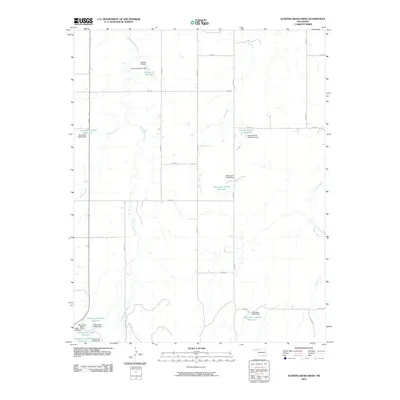
2010 Map of Sleeping Bear Creek
USGS Topo · Published 2010About this map
Sleeping Bear Creek meanders through the heart of Woodward County, defining a landscape of agricultural water management and rural section lines in the early 21st century. The map reveals an intricate network of small-scale impoundments and dams, often named after local families or designated by state-wide inventory codes. Significant water features like the Selman 29 Reservoir and George Number 2 Reservoir serve the surrounding cattle ranches and wheat fields, supported by George Kirten Number 2 Dam.
Find a feature on this map
34 named features on this map. Tap any name to fly to it.
Don’t see what you’re looking for? This feature index may not catch every label — zoom into the map to look around manually.
Map Details
Editions of this 2010 Sleeping Bear Creek Map
This is the sole edition of this map. No revisions or reprints were ever made.
Other maps of this area

1955 · Woodward
USGS Topo · 1:250,000

1958 · Woodward
USGS Topo · 1:250,000

1970 · Fairvalley SW
USGS Topo · 1:24,000

1970 · Alabaster Caverns
USGS Topo · 1:24,000

1970 · Edith
USGS Topo · 1:24,000

1970 · Sleeping Bear Creek SW
USGS Topo · 1:24,000

1970 · Sleeping Bear Creek NW
USGS Topo · 1:24,000

1970 · Sleeping Bear Creek SE
USGS Topo · 1:24,000

1971 · Selman SE
USGS Topo · 1:24,000

1971 · Selman
USGS Topo · 1:24,000