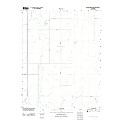
2012 Map of Sleeping Bear Creek
USGS Topo · Published 2012About this map
Sleeping Bear Creek meanders through this section of Woodward County, defining a landscape shaped by intermittent drainage and agricultural water management. The terrain is characterized by a network of named ephemeral streams and localized water storage, including Selman 29 Reservoir and George Number 2 Reservoir. A strictly rectilinear grid of section-line roads, such as E0230 Road and N2070 Road, organizes the territory into large, uniform parcels typical of Oklahoma's Great Plains ranching and farming country. Along the eastern edge, the topography becomes more complex as the land descends toward Traders Creek. In the southwest corner, Smith Gp6 Reservoir serves as a notable landmark near the junction of Gilbert Creek. This 2012 survey provides a precise look at the rural infrastructure and hydraulic features that sustain this high plains environment.
Find a feature on this map
23 named features on this map. Tap any name to fly to it.
Don’t see what you’re looking for? This feature index may not catch every label — zoom into the map to look around manually.
Map Details
Editions of this 2012 Sleeping Bear Creek Map
This is the sole edition of this map. No revisions or reprints were ever made.
Other maps of this area

1955 · Woodward
USGS Topo · 1:250,000

1958 · Woodward
USGS Topo · 1:250,000

1970 · Fairvalley SW
USGS Topo · 1:24,000

1970 · Alabaster Caverns
USGS Topo · 1:24,000

1970 · Edith
USGS Topo · 1:24,000

1970 · Sleeping Bear Creek SW
USGS Topo · 1:24,000

1970 · Sleeping Bear Creek NW
USGS Topo · 1:24,000

1970 · Sleeping Bear Creek SE
USGS Topo · 1:24,000

1971 · Selman SE
USGS Topo · 1:24,000

1971 · Selman
USGS Topo · 1:24,000