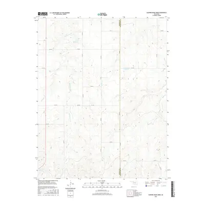
2016 Map of Sleeping Bear Creek
USGS Topo · Published 2016About this map
Sleeping Bear Creek winds through the northwestern corner of Woodward County, carving a drainage pattern into the prairie landscape of western Oklahoma. This 2016 survey captures the rural character of the region along the Harper and Woodward county line, where land use revolves around water management and section-line road access. Small impoundments like Selman 29 Reservoir and George Number 2 Reservoir dot the terrain, while seasonal drainages such as Gilbert Cr, Elm Cr, and Traders Cr define the local topography. The map illustrates a modern ranching and agricultural grid, with named section roads like Ew 19 and Ew 23 RD facilitating movement across this sparsely populated high plains area.
Find a feature on this map
19 named features on this map. Tap any name to fly to it.
Don’t see what you’re looking for? This feature index may not catch every label — zoom into the map to look around manually.
Map Details
Editions of this 2016 Sleeping Bear Creek Map
This is the sole edition of this map. No revisions or reprints were ever made.
Other maps of this area

1955 · Woodward
USGS Topo · 1:250,000

1958 · Woodward
USGS Topo · 1:250,000

1970 · Fairvalley SW
USGS Topo · 1:24,000

1970 · Alabaster Caverns
USGS Topo · 1:24,000

1970 · Edith
USGS Topo · 1:24,000

1970 · Sleeping Bear Creek SW
USGS Topo · 1:24,000

1970 · Sleeping Bear Creek NW
USGS Topo · 1:24,000

1970 · Sleeping Bear Creek SE
USGS Topo · 1:24,000

1971 · Selman SE
USGS Topo · 1:24,000

1971 · Selman
USGS Topo · 1:24,000