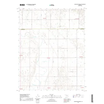
2018 Map of Sleeping Bear Creek SW
USGS Topo · Published 2018About this map
The North Canadian River meanders across this rural Oklahoma landscape, defining the hydrology and terrain of the region. The map provides a look at the boundary between Harper Co and Woodward Co, a divide marked by the section-line road network that characterizes the Great Plains' legal land survey system. Near the northern county line, Rock Church Cem stands as a significant point of interest for genealogists and local historians, anchoring the community history of the area. Settlement patterns are sparse, with Quail Ridge Acres appearing as one of the few named residential developments amidst a landscape dominated by agriculture and seasonal wetlands. The intricate grid of rural routes, including EW 29 Rd and NS 201 Rd, illustrates the modern connectivity of these sprawling township sections.
Find a feature on this map
37 named features on this map. Tap any name to fly to it.
Don’t see what you’re looking for? This feature index may not catch every label — zoom into the map to look around manually.
Map Details
Editions of this 2018 Sleeping Bear Creek SW Map
This is the sole edition of this map. No revisions or reprints were ever made.
Other maps of this area

1955 · Woodward
USGS Topo · 1:250,000

1958 · Woodward
USGS Topo · 1:250,000

1969 · Fargo
USGS Topo · 1:24,000

1969 · Woodward
USGS Topo · 1:24,000

1969 · Woodward NE
USGS Topo · 1:24,000

1970 · Sleeping Bear Creek SW
USGS Topo · 1:24,000

1970 · Sleeping Bear Creek NW
USGS Topo · 1:24,000

1970 · Sleeping Bear Creek SE
USGS Topo · 1:24,000

1971 · Fort Supply
USGS Topo · 1:24,000

1971 · Fort Supply NE
USGS Topo · 1:24,000