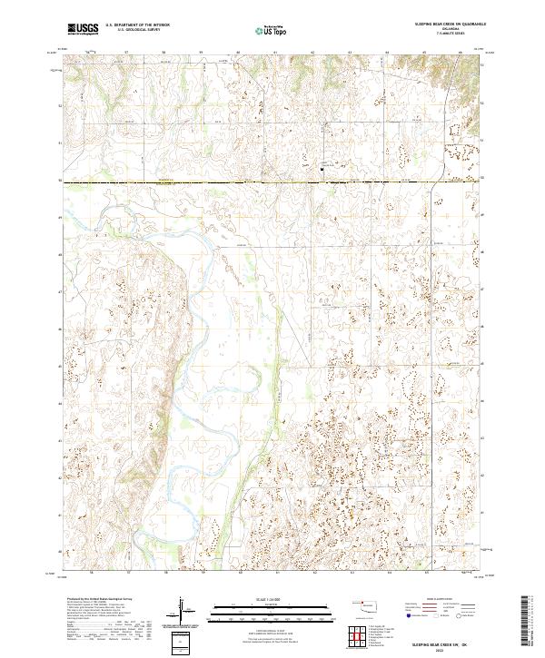
2022 Map of Sleeping Bear Creek SW
USGS Topo · Published 2022About this map
The North Canadian River meanders across this landscape, defining the rural character of the borderlands between Harper Co and Woodward Co. This modern survey reveals a region characterized by a sparse, grid-based road network including E0270 Rd and EW 29 Rd, which follow the section lines of the Public Land Survey System. The presence of the Rock Church Cem near the northern county line serves as a primary landmark for genealogists and local historians tracing early prairie settlement patterns. The river valley itself dominates the central and western portions of the quadrangle, with its complex of wetlands and varying elevations providing a detailed look at the natural hydrology that shaped development in this part of Oklahoma.
Find a feature on this map
26 named features on this map. Tap any name to fly to it.
Don’t see what you’re looking for? This feature index may not catch every label — zoom into the map to look around manually.
Map Details
Editions of this 2022 Sleeping Bear Creek SW Map
This is the sole edition of this map. No revisions or reprints were ever made.
Other maps of this area

1955 · Woodward
USGS Topo · 1:250,000

1958 · Woodward
USGS Topo · 1:250,000

1969 · Fargo
USGS Topo · 1:24,000

1969 · Woodward
USGS Topo · 1:24,000

1969 · Woodward NE
USGS Topo · 1:24,000

1970 · Sleeping Bear Creek SW
USGS Topo · 1:24,000

1970 · Sleeping Bear Creek NW
USGS Topo · 1:24,000

1970 · Sleeping Bear Creek SE
USGS Topo · 1:24,000

1971 · Fort Supply
USGS Topo · 1:24,000

1971 · Fort Supply NE
USGS Topo · 1:24,000