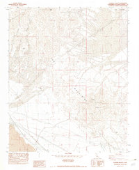
1982 Map of Sleeping Beauty
USGS Topo · Published 1982About this map
The Cady Mountains dominate this Mojave Desert landscape, characterized by high-elevation peaks and industrial utility corridors. Surveyed in the mid-1970s and edited in the early 1980s, the map reveals a rugged terrain where mining operations like the Logan Mine and Black Butte Mine were established in isolated canyons. Distinctive geological markers such as Cady Peak and the evocative Sleeping Beauty formation overlook the southern flats where the Lava field at Pisgah begins to spread. The presence of an Underground Steel Tower Transmission Line and an Underground Gas Pipeline cutting through the southern portion of the quadrangle illustrates the area's role as a vital energy corridor, even as mineral extraction remained a primary human activity at sites like the Preston Mine and Paymaster Mine.
Find a feature on this map
12 named features on this map. Tap any name to fly to it.
Don’t see what you’re looking for? This feature index may not catch every label — zoom into the map to look around manually.
Map Details
Editions of this 1982 Sleeping Beauty Map
2 editions found
Other maps of this area

1953 · San Bernardino
USGS Topo · 1:250,000

1955 · Ludlow
USGS Topo · 1:24,000

1955 · Sunshine Peak
USGS Topo · 1:24,000

1955 · Lavic Lake
USGS Topo · 1:24,000

1955 · Lavic
USGS Topo · 1:62,500

1955 · Cady Mountains
USGS Topo · 1:62,500

1955 · Broadwell Lake
USGS Topo · 1:62,500

1955 · Ludlow
USGS Topo · 1:62,500

1956 · San Bernardino
USGS Topo · 1:250,000

1957 · San Bernardino
USGS Topo · 1:250,000