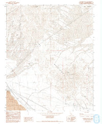
1982 Map of Sleeping Beauty
USGS Topo · Published 1993About this map
The Cady Mountains dominate this Mojave Desert landscape, characterized by the prominent volcanic landforms of Sleeping Beauty and nearby Lava flows. In the early 1980s, the area remained a center for small-scale mineral exploration, as evidenced by several named operations including the Logan Mine in the northwest and the Paymaster Mine to the southeast. The survey also traces the Preston Mine and Black Butte Mine, illustrating the persistent interest in the region's geological resources.
Find a feature on this map
12 named features on this map. Tap any name to fly to it.
Don’t see what you’re looking for? This feature index may not catch every label — zoom into the map to look around manually.
Map Details
Editions of this 1982 Sleeping Beauty Map
2 editions found
Other maps of this area

1953 · San Bernardino
USGS Topo · 1:250,000

1955 · Ludlow
USGS Topo · 1:24,000

1955 · Sunshine Peak
USGS Topo · 1:24,000

1955 · Lavic Lake
USGS Topo · 1:24,000

1955 · Lavic
USGS Topo · 1:62,500

1955 · Cady Mountains
USGS Topo · 1:62,500

1955 · Broadwell Lake
USGS Topo · 1:62,500

1955 · Ludlow
USGS Topo · 1:62,500

1956 · San Bernardino
USGS Topo · 1:250,000

1957 · San Bernardino
USGS Topo · 1:250,000