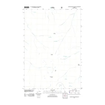
2011 Map of Sleeping Deer Mountain
USGS Topo · Published 2011About this map
Sleeping Deer Mountain dominates this high-elevation landscape within Lemhi County, serving as a central point for a complex drainage system that defines the surrounding terrain. To the south, Cache Creek Cabin stands as a notable human landmark amidst the wilderness, situated near the headwaters of Cache Creek. The area is characterized by numerous glacial tarns and alpine water bodies, including the West Fork Lakes, Liberty Lakes, and Rock Lakes, which feed into a network of tributaries such as Woodtick Creek and Pole Creek. Extensive meadows like Horse Heaven Meadows break the high ridges, providing a distinct contrast to the peaks of Martin Mountain and the strategic passage at Woodtick Summit. The map provides a detailed view of these remote hydrological patterns before they join larger systems like West Fork Camas Creek.
Find a feature on this map
24 named features on this map. Tap any name to fly to it.
Don’t see what you’re looking for? This feature index may not catch every label — zoom into the map to look around manually.
Map Details
Editions of this 2011 Sleeping Deer Mountain Map
This is the sole edition of this map. No revisions or reprints were ever made.
Other maps of this area

1930 · Casto
USGS Topo · 1:125,000

1957 · Challis
USGS Topo · 1:250,000

1960 · Challis
USGS Topo · 1:250,000

1962 · Bear Creek Point
USGS Topo · 1:24,000

1962 · Ramey Hill
USGS Topo · 1:24,000

1963 · Challis
USGS Topo · 1:250,000

1963 · Meyers Cove
USGS Topo · 1:24,000

1963 · Rock Creek
USGS Topo · 1:24,000
1963 · Aparejo Point
USGS Topo · 1:24,000
1963 · Yellowjacket
USGS Topo · 1:24,000