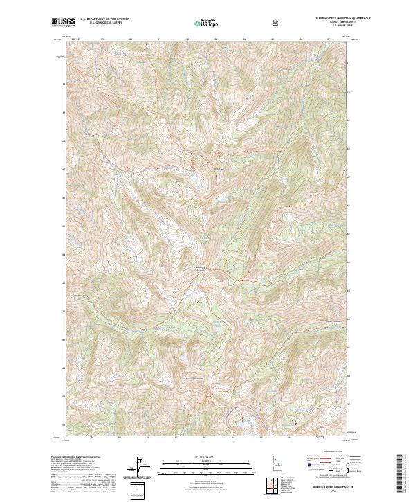
2024 Map of Sleeping Deer Mountain
USGS Topo · Published 2024About this map
Sleeping Deer Mtn anchors this high-elevation landscape within the Challis National Forest, where a network of primitive trails connects remote alpine basins and peaks. The drainage patterns are defined by numerous creeks such as Woodtick Creek and Cove Creek, which feed into isolated water bodies like Grouse Lake and the Cache Cr Lakes. The high-country terrain is marked by significant points including Martin Mtn and the broad Horse Heaven Meadows to the east. Historically significant for its lack of modern development, the area is navigated via routes like the Sleeping Deer Road (Winter Trail) and the Woodtick Ridge Trl. This survey captures the region's wilderness character, where names like Woodtick Summit and Macarte Ridge suggest a legacy of early forest service activity and traditional land use in the Idaho backcountry.
Find a feature on this map
43 named features on this map. Tap any name to fly to it.
Don’t see what you’re looking for? This feature index may not catch every label — zoom into the map to look around manually.
Map Details
Editions of this 2024 Sleeping Deer Mountain Map
This is the sole edition of this map. No revisions or reprints were ever made.
Other maps of this area

1930 · Casto
USGS Topo · 1:125,000

1957 · Challis
USGS Topo · 1:250,000

1960 · Challis
USGS Topo · 1:250,000

1962 · Bear Creek Point
USGS Topo · 1:24,000

1962 · Ramey Hill
USGS Topo · 1:24,000

1963 · Challis
USGS Topo · 1:250,000

1963 · Meyers Cove
USGS Topo · 1:24,000

1963 · Rock Creek
USGS Topo · 1:24,000
1963 · Aparejo Point
USGS Topo · 1:24,000
1963 · Yellowjacket
USGS Topo · 1:24,000