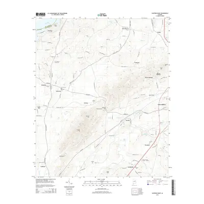
2014 Map of Sleeping Giant
USGS Topo · Published 2014About this map
Renfroe Mtn and the namesake Sleeping Giant landform dominate this central Talladega County landscape, where the ridges of the Appalachian foothills meet the creek-fed valleys below. The area is marked by numerous small settlements and family-named points of interest, including Renfroe, Mardisville, and Howells Cove. Water features like Talladega Cr and Logan Martin Lake at Collins Bend define the drainage patterns that shaped the local geography. Genealogists will find a wealth of specific data here, as the map identifies several burial grounds such as Mardisville Cem, Allen Sims Cem, and the Freeze Cem near Jonesview. This 2014 survey documents the modern layout of Talladega, showing the expansion of roads like the Old Talladega Hwy and Plant Rd as they navigate the hollows of Dark Hollow and Rocky Hollow.
Find a feature on this map
113 named features on this map. Tap any name to fly to it.
Don’t see what you’re looking for? This feature index may not catch every label — zoom into the map to look around manually.
Map Details
Editions of this 2014 Sleeping Giant Map
This is the sole edition of this map. No revisions or reprints were ever made.
Other maps of this area

1889 · Springville
USGS Topo · 1:125,000

1890 · Talladega
USGS Topo · 1:125,000

1892 · Springville
USGS Topo · 1:125,000

1892 · Talladega
USGS Topo · 1:125,000

1943 · Talladega
USGS Topo · 1:62,500

1946 · Talladega
USGS Topo · 1:62,500

1947 · Eastaboga
USGS Topo · 1:24,000

1947 · Ragland
USGS Topo · 1:62,500

1947 · Riverside
USGS Topo · 1:24,000

1951 · Laniers
USGS Topo · 1:24,000