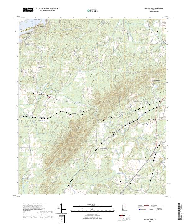
2024 Map of Sleeping Giant
USGS Topo · Published 2024About this map
Sleeping Giant and Renfroe Mtn dominate the central topography of this Alabama landscape, where the ridges of the Appalachian foothills meet the historical corridors of Talladega. The map reveals a dense network of early burial sites and rural communities, including the namesake peaks and the smaller Bucky Peak. Toward the northwest, the Coosa River forms Collins Bend near the Lincoln city limits, flowing into the expansive Logan Martin Lake.
Find a feature on this map
117 named features on this map. Tap any name to fly to it.
Don’t see what you’re looking for? This feature index may not catch every label — zoom into the map to look around manually.
Map Details
Editions of this 2024 Sleeping Giant Map
This is the sole edition of this map. No revisions or reprints were ever made.
Other maps of this area

1889 · Springville
USGS Topo · 1:125,000

1890 · Talladega
USGS Topo · 1:125,000

1892 · Springville
USGS Topo · 1:125,000

1892 · Talladega
USGS Topo · 1:125,000

1943 · Talladega
USGS Topo · 1:62,500

1946 · Talladega
USGS Topo · 1:62,500

1947 · Eastaboga
USGS Topo · 1:24,000

1947 · Ragland
USGS Topo · 1:62,500

1947 · Riverside
USGS Topo · 1:24,000

1951 · Laniers
USGS Topo · 1:24,000