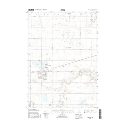
2016 Map of Sleepy Eye
USGS Topo · Published 2016About this map
Sleepy Eye serves as the focal point of this Brown County landscape, situated just south of the waters of Sleepy Eye Lake. The town's layout is defined by a traditional grid of streets such as Walnut St SW and Linden St SE, with Saint Marys Cem and Home Cem located near the northern edge of the settlement. The surrounding prairie is heavily managed for drainage, marked by extensive systems like County Ditch Number Ten and County Ditch Number Thirteen, which feed into the meandering Cottonwood River as it cuts across the southern portion of the quadrangle. Significant landmarks include the Sleepy Eye Municipal Airport south of town and the large Rose Lake Bed, indicating the historical transformation of local hydrology for agricultural land use.
Find a feature on this map
38 named features on this map. Tap any name to fly to it.
Don’t see what you’re looking for? This feature index may not catch every label — zoom into the map to look around manually.
Map Details
Editions of this 2016 Sleepy Eye Map
This is the sole edition of this map. No revisions or reprints were ever made.
Other maps of this area

1953 · Morgan
USGS Topo · 1:62,500

1953 · New Ulm
USGS Topo · 1:250,000

1957 · New Ulm
USGS Topo · 1:250,000

1958 · New Ulm
USGS Topo · 1:250,000

1964 · Sleepy Eye NW
USGS Topo · 1:24,000

1964 · Sleepy Eye
USGS Topo · 1:24,000

1964 · Essig
USGS Topo · 1:24,000

1964 · St George
USGS Topo · 1:24,000

1967 · New Ulm
USGS Topo · 1:250,000

1967 · Lake Hanska West
USGS Topo · 1:24,000