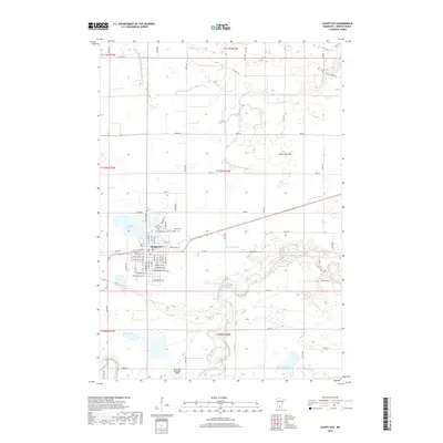
2019 Map of Sleepy Eye
USGS Topo · Published 2019About this map
Sleepy Eye serves as the focal point of this Brown County landscape, where the town's residential grid transitions into a vast network of agricultural sections. The geography is defined by its water management and drainage history, visible in the engineered paths of County Ditch Number Thirteen and County Ditch Number Ten, alongside the expansive Rose Lake Bed to the northeast. To the west of the city center, Sleepy Eye Lake provides a natural landmark, while the Cottonwood River meanders across the southern reaches of the quadrangle.
Find a feature on this map
43 named features on this map. Tap any name to fly to it.
Don’t see what you’re looking for? This feature index may not catch every label — zoom into the map to look around manually.
Map Details
Editions of this 2019 Sleepy Eye Map
This is the sole edition of this map. No revisions or reprints were ever made.
Other maps of this area

1953 · Morgan
USGS Topo · 1:62,500

1953 · New Ulm
USGS Topo · 1:250,000

1957 · New Ulm
USGS Topo · 1:250,000

1958 · New Ulm
USGS Topo · 1:250,000

1964 · Sleepy Eye NW
USGS Topo · 1:24,000

1964 · Sleepy Eye
USGS Topo · 1:24,000

1964 · Essig
USGS Topo · 1:24,000

1964 · St George
USGS Topo · 1:24,000

1967 · New Ulm
USGS Topo · 1:250,000

1967 · Lake Hanska West
USGS Topo · 1:24,000