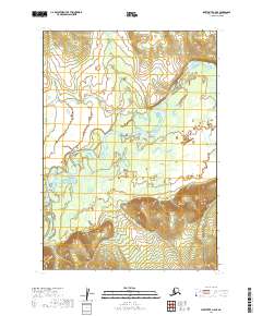
2019 Map of Sleetmute A-5 SE
USGS Topo · Published 2019About this map
The Holitna River meanders across this interior landscape within the Bethel Census Area, illustrating a complex network of active and abandoned river channels. Flowing through the central and southern portions of the map, the river's path is marked by sharp oxbows and evidence of historical course changes that define the low-lying terrain. To the north, the waters of Portage Creek join the drainage system, cutting through the elevation changes that characterize the northern and southern quadrants. This survey by the U.S. Geological Survey provides a clear view of the natural hydrology and topographical relief that dictate movement through this roadless region of the Alaska wilderness.
Find a feature on this map
6 named features on this map. Tap any name to fly to it.
Don’t see what you’re looking for? This feature index may not catch every label — zoom into the map to look around manually.
Map Details
Editions of this 2019 Sleetmute A-5 SE Map
This is the sole edition of this map. No revisions or reprints were ever made.
Other maps of this area

1950 · Sleetmute
USGS Topo · 1:250,000

1950 · Taylor Mountains
USGS Topo · 1:250,000

1951 · Taylor Mountains
USGS Topo · 1:250,000

1954 · Sleetmute
USGS Topo · 1:250,000

1954 · Taylor Mountains
USGS Topo · 1:250,000

1954 · Sleetmute A-5
USGS Topo · 1:63,360

1954 · Taylor Mountains D-5
USGS Topo · 1:63,360
1954 · Sleetmute A-4
USGS Topo · 1:63,360

1954 · Taylor Mountains D-4
USGS Topo · 1:63,360
2019 · Taylor Mountains D-4 NW
USGS Topo · 1:25,000