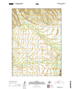
2019 Map of Sleetmute A-5 SW
USGS Topo · Published 2019About this map
Bakbuk Cr meanders across the lower half of this landscape, its winding course defining the drainage patterns in the southern interior of this Alaskan region. The Holitna River clips the southeastern corner of the sheet, serving as a primary waterway for this river-and-wetland system. These watercourses are the dominant landmarks across the public land survey townships of t12n r48w and t11n r48w, where the lack of roads or established settlements reflects the untracked character of the Bethel Census Area in the early 21st century. The map provides a precise record of the elevation contours and natural drainage before any significant modern development altered these remote basins.
Find a feature on this map
6 named features on this map. Tap any name to fly to it.
Don’t see what you’re looking for? This feature index may not catch every label — zoom into the map to look around manually.
Map Details
Editions of this 2019 Sleetmute A-5 SW Map
This is the sole edition of this map. No revisions or reprints were ever made.
Other maps of this area

1950 · Sleetmute
USGS Topo · 1:250,000

1950 · Taylor Mountains
USGS Topo · 1:250,000

1951 · Taylor Mountains
USGS Topo · 1:250,000

1954 · Sleetmute
USGS Topo · 1:250,000

1954 · Taylor Mountains
USGS Topo · 1:250,000

1954 · Sleetmute A-5
USGS Topo · 1:63,360

1954 · Taylor Mountains D-6
USGS Topo · 1:63,360

1954 · Taylor Mountains D-5
USGS Topo · 1:63,360

1954 · Sleetmute A-6
USGS Topo · 1:63,360
2019 · Taylor Mountains D-6 NE
USGS Topo · 1:25,000