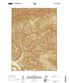
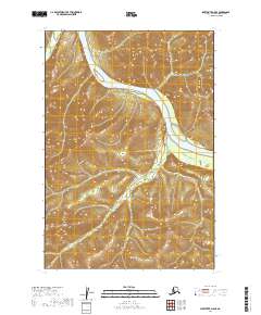
2019 Map of Sleetmute C-5 NE
USGS Topo · Published 2019About this map
The interior wilderness of the Bethel Census Area is defined by high ridgelines and complex drainage patterns in this 2019 survey. The terrain is structured by the Public Land Survey System boundaries of T19n R46w, T19n R45w, T18n R46w, and T18n R45w. These administrative townships provide the only named landmarks in an otherwise unnamed landscape of steep slopes and deep valleys. The absence of roads, trails, or structures indicates a highly secluded region where the natural topography remains the primary focus. Modern elevation data highlights the intricate contours of the uplands, offering a precise view of the physical geography of this portion of Alaska before any significant human development or infrastructure was recorded on the topographic record.
Find a feature on this map
4 named features on this map. Tap any name to fly to it.
Don’t see what you’re looking for? This feature index may not catch every label — zoom into the map to look around manually.
Map Details
Editions of this 2019 Sleetmute C-5 NE Map
This is the sole edition of this map. No revisions or reprints were ever made.
Other maps of this area

1950 · Sleetmute
USGS Topo · 1:250,000

1954 · Sleetmute C-4
USGS Topo · 1:63,360

1954 · Sleetmute D-5
USGS Topo · 1:63,360

1954 · Sleetmute D-4
USGS Topo · 1:63,360

1954 · Sleetmute C-5
USGS Topo · 1:63,360

1954 · Sleetmute
USGS Topo · 1:250,000
2019 · Sleetmute C-4 NW
USGS Topo · 1:25,000
2019 · Sleetmute D-5 SW
USGS Topo · 1:25,000
2019 · Sleetmute D-4 SW
USGS Topo · 1:25,000
2019 · Sleetmute D-5 SE
USGS Topo · 1:25,000