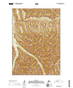
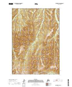
2019 Map of Sleetmute C-5 SE
USGS Topo · Published 2019About this map
The Oskawalik River meanders through this portion of the Bethel Census Area, carving a distinct valley through the upland terrain. This 2019 survey documents a landscape dominated by the natural drainage patterns of the river and its smaller tributary, Vreeland Cr. The lack of named settlements or infrastructure on this sheet emphasizes the wilderness character of this region of Alaska, where the landscape is defined almost entirely by its hydrography and elevation contours. The map provides a precise record of the river's course as it was in the late 2010s, offering a clear baseline for studying long-term changes in the river morphology and the surrounding drainage basin.
Find a feature on this map
8 named features on this map. Tap any name to fly to it.
Don’t see what you’re looking for? This feature index may not catch every label — zoom into the map to look around manually.
Map Details
Editions of this 2019 Sleetmute C-5 SE Map
This is the sole edition of this map. No revisions or reprints were ever made.
Other maps of this area

1950 · Sleetmute
USGS Topo · 1:250,000

1954 · Sleetmute C-4
USGS Topo · 1:63,360

1954 · Sleetmute C-5
USGS Topo · 1:63,360

1954 · Sleetmute
USGS Topo · 1:250,000

1954 · Sleetmute B-5
USGS Topo · 1:63,360

1954 · Sleetmute B-4
USGS Topo · 1:63,360
2019 · Sleetmute B-5 NE
USGS Topo · 1:25,000
2019 · Sleetmute C-4 NW
USGS Topo · 1:25,000
2019 · Sleetmute C-5 NW
USGS Topo · 1:25,000
2019 · Sleetmute B-5 NW
USGS Topo · 1:25,000