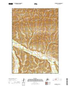
2019 Map of Sleetmute C-5 NW
USGS Topo · Published 2019About this map
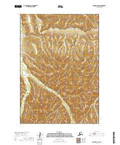
The Kuskokwim Mountains dominate this landscape within the Bethel Census Area, where high elevation contours reveal a series of ridges and steep drainage basins. This interior Alaskan terrain is defined by the Oskawalik River, which winds through the southern half of the quadrangle, collecting flow from smaller tributaries. The map details a strictly wild environment, emphasizing the natural hydrography and topography of the region rather than human settlement or infrastructure. In the northern reaches, Downey Cr and Eightmile Cr carve out narrow valleys through the upland terrain. These watercourses are the primary geographical markers in an otherwise uninhabited stretch of the western Alaska interior, providing essential context for understanding the water management and drainage patterns of the Kuskokwim River watershed.
Find a feature on this map
8 named features on this map. Tap any name to fly to it.
Don’t see what you’re looking for? This feature index may not catch every label — zoom into the map to look around manually.
Map Details
Editions of this 2019 Sleetmute C-5 NW Map
This is the sole edition of this map. No revisions or reprints were ever made.
Other maps of this area

1950 · Sleetmute
USGS Topo · 1:250,000

1954 · Sleetmute D-5
USGS Topo · 1:63,360

1954 · Sleetmute D-6
USGS Topo · 1:63,360

1954 · Sleetmute C-6
USGS Topo · 1:63,360

1954 · Sleetmute C-5
USGS Topo · 1:63,360

1954 · Sleetmute
USGS Topo · 1:250,000
2019 · Sleetmute D-5 SW
USGS Topo · 1:25,000
2019 · Sleetmute D-6 SE
USGS Topo · 1:25,000
2019 · Sleetmute D-5 SE
USGS Topo · 1:25,000
2019 · Sleetmute C-5 SE
USGS Topo · 1:25,000