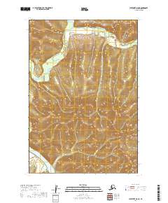
2019 Map of Sleetmute D-5 NE
USGS Topo · Published 2019About this map
The Kuskokwim River flows through the southwestern corner of this wilderness quadrangle, meeting smaller tributaries like Downey Cr and California Cr. To the north, the landscape is defined by the wandering course of the George River and its East Fork George River. This terrain is dominated by high ridges and drainage basins rather than permanent human settlements, illustrating the remote interior of the Bethel Census Area. The lack of roads or structures in this 2019 survey reflects the region's character as a roadless expanse where transport and travel are primarily dictated by the river systems. It is an essential map for understanding the hydrological network that feeds into the Kuskokwim, tracing the natural contours and township lines of the t21n r46w and t22n r45w surveying districts.
Find a feature on this map
9 named features on this map. Tap any name to fly to it.
Don’t see what you’re looking for? This feature index may not catch every label — zoom into the map to look around manually.
Map Details
Editions of this 2019 Sleetmute D-5 NE Map
This is the sole edition of this map. No revisions or reprints were ever made.
Other maps of this area

1950 · Sleetmute
USGS Topo · 1:250,000

1951 · Iditarod
USGS Topo · 1:250,000

1954 · Sleetmute D-5
USGS Topo · 1:63,360

1954 · Sleetmute D-4
USGS Topo · 1:63,360

1954 · Iditarod A-4
USGS Topo · 1:63,360

1954 · Iditarod A-3
USGS Topo · 1:63,360

1954 · Sleetmute
USGS Topo · 1:250,000

1956 · Iditarod
USGS Topo · 1:250,000
2019 · Sleetmute D-5 NW
USGS Topo · 1:25,000
2019 · Sleetmute D-5 SW
USGS Topo · 1:25,000