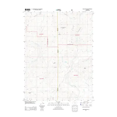
2013 Map of Slide Mountain
USGS Topo · Published 2013About this map
Slide Mountain and the high country along the Moffat and Routt County line are the central focus of this 2013 topographic survey. Part of the Routt National Forest, the landscape is defined by its water management systems and high peaks like Buck Mountain and Agner Mountain. Several man-made waterways, including the Tipton Ditch, McKinley Ditch Number 1, and McKinley Ditch Number 2, demonstrate the historical reliance on complex irrigation to manage resources between basins. For recreation and access, the map details established pathways such as the Bears Ears Trail, Sawmill Trail, and the North Fork Elkhead Trail, which weave through drainage systems like Long Gulch and Cottonwood Gulch. Smaller water bodies like Angel Spring and the Anderson Reservoir are tucked into the drainages of Elkhead Creek, providing essential landmarks for navigation and local land use.
Find a feature on this map
30 named features on this map. Tap any name to fly to it.
Don’t see what you’re looking for? This feature index may not catch every label — zoom into the map to look around manually.
Map Details
Editions of this 2013 Slide Mountain Map
This is the sole edition of this map. No revisions or reprints were ever made.
Other maps of this area

1923 · Elkhead Creek
USGS Topo · 1:62,500

1923 · Pilot Knob
USGS Topo · 1:62,500

1924 · Elkhead Creek
USGS Topo · 1:62,500

1925 · Pilot Knob
USGS Topo · 1:62,500

1954 · Craig
USGS Topo · 1:250,000

1957 · Craig
USGS Topo · 1:250,000

1958 · Craig
USGS Topo · 1:250,000

1960 · Craig
USGS Topo · 1:250,000

1962 · Craig
USGS Topo · 1:250,000
1962 · Bears Ears Peaks
USGS Topo · 1:24,000