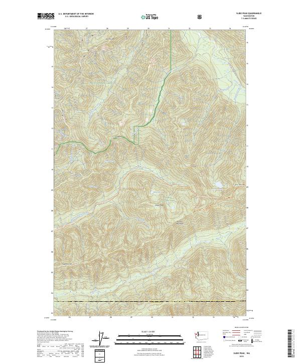
2023 Map of Slide Peak
USGS Topo · Published 2023About this map
The Olympic Mountains dominate this high-elevation terrain where the headwaters of several major river systems originate. The deep drainage of the Sol Duc River and its South Fork Sol Duc River shape the northern landscape, while the southern half is defined by the Bogachiel River and its north fork. These alpine reaches are protected within the Olympic Wilderness and Olympic National Park, showing a wilderness environment largely untouched by modern development. Significant landmarks include the sharp rise of Slide Peak and the evocative Misery Peak near Ring Lake. The Pacific Northwest National Scenic Trail winds through these heights, crossing the Low Divide and providing access to the interior of the peninsula. Remote water bodies like Blackwood Lake are situated in steep glacial cirques, emphasizing the geological isolation of the region.
Find a feature on this map
46 named features on this map. Tap any name to fly to it.
Don’t see what you’re looking for? This feature index may not catch every label — zoom into the map to look around manually.
Map Details
Editions of this 2023 Slide Peak Map
This is the sole edition of this map. No revisions or reprints were ever made.
Other maps of this area

1918 · Lake Crescent
USGS Topo · 1:62,500

1922 · Pysht
USGS Topo · 1:62,500

1922 · Lake Crescent
USGS Topo · 1:62,500

1939 · Mount Tom
USGS Topo · 1:62,500

1942 · Pysht
USGS Topo · 1:62,500

1943 · Spruce Mountain
USGS Topo · 1:62,500

1943 · Copalis Beach
USGS Topo · 1:250,000

1950 · Mount Muller
USGS Topo · 1:24,000

1950 · Lake Crescent
USGS Topo · 1:24,000

1950 · Slide Peak
USGS Topo · 1:24,000