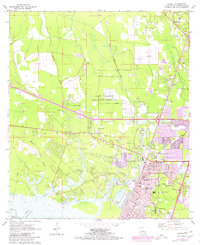
1971 Map of Slidell
USGS Topo · Published 1980About this map
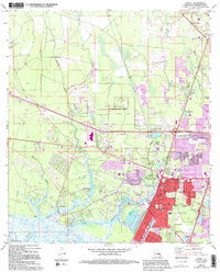
Camp Villerre occupies a significant portion of the landscape north of Slidell, serving as a National Guard training area during a period of rapid suburban expansion in St. Tammany Parish. The map reveals the intricate water network feeding into Lake Pontchartrain, with Bayou Bonfouca, Bayou Paquet, and Bayou Vincent meandering through low-lying terrain. The intersection of the Gulf Mobile and Ohio and Southern railroads highlights the area's importance as a transportation hub, supporting local settlements like Alton, St Joe, and McClane City.
Find a feature on this map
62 named features on this map. Tap any name to fly to it.
Don’t see what you’re looking for? This feature index may not catch every label — zoom into the map to look around manually.
Map Details
Editions of this 1971 Slidell Map
5 editions found
Other maps of this area

1892 · Chef Menteur
USGS Topo · 1:62,500

1893 · Rigolets
USGS Topo · 1:62,500

1914 · Nicholson
USGS Topo · 1:62,500

1921 · Nicholson
USGS Topo · 1:62,500

1935 · Slidell
USGS Topo · 1:62,500

1936 · North Shore
USGS Topo · 1:31,680

1936 · South Point
USGS Topo · 1:31,680

1936 · Chef Menteur
USGS Topo · 1:62,500

1936 · Rigolets
USGS Topo · 1:62,500

1939 · Slidell
USGS Topo · 1:62,500