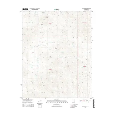
2014 Map of Slidy Mountain
USGS Topo · Published 2014About this map
Slidy Mtn and the northern reaches of the Delamar Mountains define this high-desert landscape in Lincoln County. The map reveals an intricate network of water sources essential for survival and mining in this arid region, including the curiously named Monkey Wrench Wash and Abandoned Spring. Of particular interest to industrial historians is the sequence of numbered water sources—Tunnel Number One Spring, Tunnel Number Two Spring, and Tunnel Number Three Spring—clustered near the S Fork Cedar Wash. These features, along with Tunnel Spring, suggest historical underground workings or water-management infrastructure that relied on the steep local relief. Grounded by summits like Applewhite Summit and Denton Summit, the area is traversed by rugged tracks such as Bishop Rd and Blith Rd, providing access to isolated points like Indian Basin and Willow Canyon.
Find a feature on this map
38 named features on this map. Tap any name to fly to it.
Don’t see what you’re looking for? This feature index may not catch every label — zoom into the map to look around manually.
Map Details
Editions of this 2014 Slidy Mountain Map
This is the sole edition of this map. No revisions or reprints were ever made.
Other maps of this area

1885 · Pioche
USGS Topo · 1:250,000

1886 · Pioche
USGS Topo · 1:250,000

1954 · Caliente
USGS Topo · 1:250,000

1959 · Caliente
USGS Topo · 1:250,000

1969 · Delamar
USGS Topo · 1:24,000

1969 · Gregerson Basin
USGS Topo · 1:24,000

1969 · Elgin
USGS Topo · 1:24,000

1969 · Elgin NE
USGS Topo · 1:24,000

1969 · Slidy Mountain
USGS Topo · 1:24,000

1969 · Elgin SW
USGS Topo · 1:24,000