
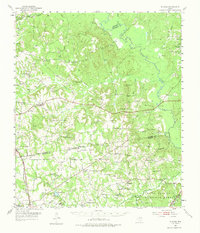
1952 Map of Slocum
USGS Topo · Published 1953About this map
The rolling timberlands of East Texas are anchored here by Slocum and Augusta, where a network of family-named creeks like Ioni Creek and San Pedro Creek drains toward the Neches River. The landscape in the early 1950s shows a transition between traditional agriculture and the growing energy industry, with scattered Oil Wells appearing near the Southern Pacific rail line at Grapeland. This region is deeply rooted in communal life, evidenced by the numerous rural churches and burial grounds that serve as landmarks, such as Livelyville Ch (Cem) and Union Hope Sch & Cem.
Find a feature on this map
75 named features on this map. Tap any name to fly to it.
Don’t see what you’re looking for? This feature index may not catch every label — zoom into the map to look around manually.
Map Details
Editions of this 1952 Slocum Map
2 editions found
Other maps of this area

1943 · Rusk
USGS Topo · 1:62,500

1945 · Rusk
USGS Topo · 1:62,500

1946 · Alto
USGS Topo · 1:62,500

1949 · Palestine
USGS Topo · 1:62,500

1950 · Palestine
USGS Topo · 1:62,500

1950 · Crockett NE
USGS Topo · 1:24,000

1950 · Ratcliff
USGS Topo · 1:24,000

1951 · Grapeland
USGS Topo · 1:24,000

1951 · Crockett NE
USGS Topo · 1:24,000

1951 · Ratcliff
USGS Topo · 1:24,000