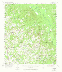
1952 Map of Slocum
USGS Topo · Published 1975About this map
The Old San Antonio Road cuts through this East Texas landscape, marking a historical corridor that predates modern statehood. Stretching across the border of Anderson and Houston counties, the area is defined by its rural community clusters such as Slocum and Augusta, many centered around local institutions like Livelyville Ch and Jenkins Chapel. The western edge is served by the Missouri Pacific railroad, while the eastern boundary is shaped by the winding Neches River.
Find a feature on this map
66 named features on this map. Tap any name to fly to it.
Don’t see what you’re looking for? This feature index may not catch every label — zoom into the map to look around manually.
Map Details
Editions of this 1952 Slocum Map
2 editions found

Other maps of this area

1943 · Rusk
USGS Topo · 1:62,500

1945 · Rusk
USGS Topo · 1:62,500

1946 · Alto
USGS Topo · 1:62,500

1949 · Palestine
USGS Topo · 1:62,500

1950 · Palestine
USGS Topo · 1:62,500

1950 · Crockett NE
USGS Topo · 1:24,000

1950 · Ratcliff
USGS Topo · 1:24,000

1951 · Grapeland
USGS Topo · 1:24,000

1951 · Crockett NE
USGS Topo · 1:24,000

1951 · Ratcliff
USGS Topo · 1:24,000