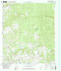
1982 Map of Slocum
USGS Topo · Published 1982About this map
Slocum and its surrounding oil-producing landscape dominate this East Texas survey, characterized by the extensive Slocum Oil Field and associated infrastructure like the refinery and various oil wells. The terrain is a network of creek drainages, including Squirrel Creek, Boggy Creek, and Ioni Creek, which feeds into the Ioni Marsh to the southeast. This period captures the rural community's structure through its local institutions, including the High Sch and several country churches such as Union Hope Ch and St James Ch.
Find a feature on this map
29 named features on this map. Tap any name to fly to it.
Don’t see what you’re looking for? This feature index may not catch every label — zoom into the map to look around manually.
Map Details
Editions of this 1982 Slocum Map
2 editions found
Other maps of this area

1949 · Palestine
USGS Topo · 1:62,500

1950 · Palestine
USGS Topo · 1:62,500

1951 · Elkhart
USGS Topo · 1:62,500

1951 · Jacksonville
USGS Topo · 1:62,500

1952 · Slocum
USGS Topo · 1:62,500

1953 · Palestine
USGS Topo · 1:250,000

1957 · Palestine
USGS Topo · 1:250,000

1981 · Palestine
USGS Topo · 1:100,000
1982 · Maydelle
USGS Topo · 1:24,000
1982 · Percilla
USGS Topo · 1:24,000