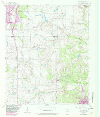
1956 Map of Sloop Creek
USGS Topo · Published 1982About this map
Vogtsberger Oil Field dominates the central terrain of this North Texas landscape, where the petroleum industry and cattle ranching intersect across the borders of Archer, Wichita, and Clay Counties. The map reveals a dense network of tanks and a Compressor Station supporting the local energy economy. To the north, the urban expansion of Wichita Falls is visible near Kickapoo Downtown Airpark, while the southern reaches show the emerging shoreline of Lake Arrowhead and the adjacent Lake Arrowhead State Park.
Find a feature on this map
26 named features on this map. Tap any name to fly to it.
Don’t see what you’re looking for? This feature index may not catch every label — zoom into the map to look around manually.
Map Details
Editions of this 1956 Sloop Creek Map
Other maps of this area

1931 · Archer City
USGS Topo · 1:62,500

1954 · Wichita Falls
USGS Topo · 1:250,000

1956 · Sloop Creek
USGS Topo · 1:24,000

1956 · Lake Wichita
USGS Topo · 1:24,000

1957 · Wichita Falls West
USGS Topo · 1:24,000

1957 · Wichita Falls East
USGS Topo · 1:62,500

1957 · Wichita Falls East
USGS Topo · 1:24,000

1957 · Wichita Falls West
USGS Topo · 1:62,500

1958 · Wichita Falls
USGS Topo · 1:250,000

1963 · Deer Creek
USGS Topo · 1:24,000