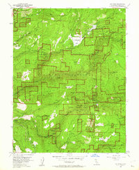
1952 Map of Sly Park
USGS Topo · Published 1962About this map
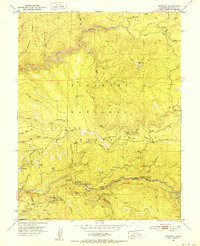
Jenkinson Lake occupies the center of this terrain, its basin newly defined by the Sly Park Dam as part of the mid-century water management efforts in the Eldorado National Forest. Blue hatching on the map reveals the specific areas destined for submergence by the reservoir, a critical detail for those researching the valley's original floor. The landscape is a network of mid-century industrial activity and forestry, where the Phippen Mill (Site) and numerous mining operations like the Hazel Creek Mine and Blue Gouge Mine speak to the local timber and mineral economy. To the south, the North Fork Cosumnes River and its tributaries, such as Grizzly Creek and Cedar Canyon, cut through the ridges. Remote outposts like the Grizzly Flat Guard Station and Sly Park Guard Sta provide geographic anchors for researchers tracing the early administrative and fire-lookout history of the Sierra foothills.
Find a feature on this map
54 named features on this map. Tap any name to fly to it.
Don’t see what you’re looking for? This feature index may not catch every label — zoom into the map to look around manually.
Map Details
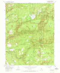
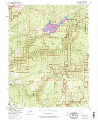
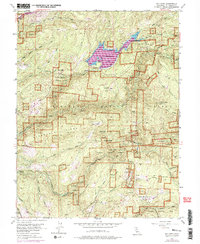
Editions of this 1952 Sly Park Map
5 editions found

Other maps of this area

1889 · Pyramid Peak
USGS Topo · 1:125,000

1891 · Placerville
USGS Topo · 1:125,000

1891 · Pyramid Peak
USGS Topo · 1:125,000

1892 · Placerville
USGS Topo · 1:125,000

1893 · Placerville
USGS Topo · 1:125,000

1895 · Pyramid Peak
USGS Topo · 1:125,000

1896 · Pyramid Peak
USGS Topo · 1:125,000

1947 · Sacramento
USGS Topo · 1:250,000

1948 · Sacramento
USGS Topo · 1:250,000
1950 · Riverton
USGS Topo · 1:24,000