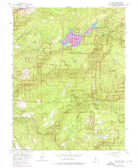
1952 Map of Sly Park
USGS Topo · Published 1976About this map
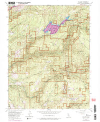
Jenkinson Lake sits at the heart of this landscape, created by the Sly Park Dam within the Eldorado National Forest. The map documents a rugged section of El Dorado County defined by the steep drainage basins of the Cosumnes River and Sly Park Creek. A legacy of resource extraction is evident in the numerous mining operations scattered across the ridges, including the Mt Hope Mine, Cosumnes Mine, and Hazel Creek Mine. These sites, along with the Grizzly Flat Guard Station and Sly Park Guard Sta, point to the area's dual history of industrial prospecting and federal land management.
Find a feature on this map
51 named features on this map. Tap any name to fly to it.
Don’t see what you’re looking for? This feature index may not catch every label — zoom into the map to look around manually.
Map Details
Editions of this 1952 Sly Park Map
5 editions found
Other maps of this area

1889 · Pyramid Peak
USGS Topo · 1:125,000

1891 · Placerville
USGS Topo · 1:125,000

1891 · Pyramid Peak
USGS Topo · 1:125,000

1892 · Placerville
USGS Topo · 1:125,000

1893 · Placerville
USGS Topo · 1:125,000

1895 · Pyramid Peak
USGS Topo · 1:125,000

1896 · Pyramid Peak
USGS Topo · 1:125,000

1947 · Sacramento
USGS Topo · 1:250,000

1948 · Sacramento
USGS Topo · 1:250,000

1950 · Riverton
USGS Topo · 1:24,000