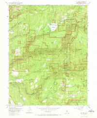
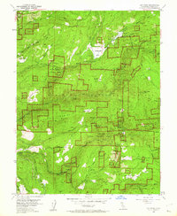
1952 Map of Sly Park
USGS Topo · Published 1972About this map
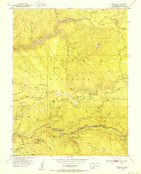
Jenkinson Lake and the surrounding Eldorado National Forest dominate this mid-century landscape, where industrial logging and mining operations define the rugged terrain. The map records a complex network of water management features, including the Sly Park Dam, the Crawford Ditch, and a pipe line labeled as under construction, illustrating the region's evolving infrastructure. Mining heritage is prominent throughout the Sturdevant Ridge and Baltic Ridge areas, with sites such as the Hazel Creek Mine, Blue Gouge Mine, and Cosumnes Mine clearly marked.
Find a feature on this map
76 named features on this map. Tap any name to fly to it.
Don’t see what you’re looking for? This feature index may not catch every label — zoom into the map to look around manually.
Map Details
Editions of this 1952 Sly Park Map
5 editions found
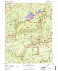
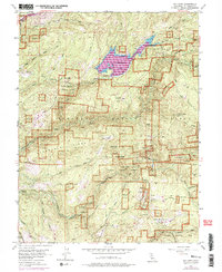

Other maps of this area

1889 · Pyramid Peak
USGS Topo · 1:125,000

1891 · Placerville
USGS Topo · 1:125,000

1891 · Pyramid Peak
USGS Topo · 1:125,000

1892 · Placerville
USGS Topo · 1:125,000

1893 · Placerville
USGS Topo · 1:125,000

1895 · Pyramid Peak
USGS Topo · 1:125,000

1896 · Pyramid Peak
USGS Topo · 1:125,000

1947 · Sacramento
USGS Topo · 1:250,000

1948 · Sacramento
USGS Topo · 1:250,000
1950 · Riverton
USGS Topo · 1:24,000