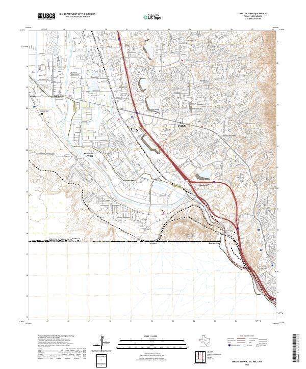
2022 Map of Smeltertown
USGS Topo · Published 2022About this map
Sierra de Cristo Rey and the Franklin Mountains dominate the horizon where the boundaries of Texas, New Mexico, and Mexico converge. This modern survey illustrates the complex landscape of El Paso and Sunland Park, where the Rio Grande serves as both a life-giving water source and a political divide. The map details the transition from the industrial legacy of Smeltertown and the Portland Cement Reservoir to the residential expansion of Coronado Hills and Buena Vista.
Find a feature on this map
39 named features on this map. Tap any name to fly to it.
Don’t see what you’re looking for? This feature index may not catch every label — zoom into the map to look around manually.
Map Details
Editions of this 2022 Smeltertown Map
This is the sole edition of this map. No revisions or reprints were ever made.
Other maps of this area

1896 · El Paso
USGS Topo · 1:125,000

1908 · El Paso
USGS Topo · 1:125,000

1917 · Canutillo
USGS Topo · 1:62,500

1919 · Canutillo
USGS Topo · 1:62,500

1939 · Ysleta
USGS Topo · 1:62,500

1941 · El Paso
USGS Topo · 1:31,680

1941 · Ysleta
USGS Topo · 1:62,500

1942 · Fort Bliss
USGS Topo · 1:62,500

1943 · El Paso
USGS Topo · 1:31,680

1945 · Ysleta
USGS Topo · 1:62,500