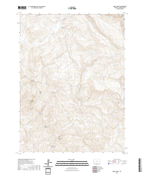
2021 Map of Smiley Draw
USGS Topo · Published 2021About this map
Wild Horse Butte and the surrounding Wild Horse Basin dominate this high-desert landscape in Carbon County. The terrain is defined by a series of dramatic drainages and mesas, notably the Deep Creek Rim and the volcanic-named Little Wild Horse Buttes. Water sources are critical but sparse in this environment, represented here by Big Spring and Smiley Spring, which feed into local systems like Cherokee Cr. These springs likely served as vital hubs for early ranching and transit through the high basins. Remote access is provided by unpaved tracks such as Wild Cow Rd and Wild Horse Rd, tracing the natural contours of Smiley Draw and White Rock Draw. The map captures a section of the American West where topography and hydrology strictly dictate the patterns of human movement and land use.
Find a feature on this map
24 named features on this map. Tap any name to fly to it.
Don’t see what you’re looking for? This feature index may not catch every label — zoom into the map to look around manually.
Map Details
Editions of this 2021 Smiley Draw Map
This is the sole edition of this map. No revisions or reprints were ever made.
Other maps of this area

1932 · Savery
USGS Topo · 1:96,000

1940 · Savery
USGS Topo · 1:125,000

1954 · Rawlins
USGS Topo · 1:250,000

1957 · Baggs
USGS Topo · 1:62,500

1957 · Doty Mountain
USGS Topo · 1:62,500

1958 · Rawlins
USGS Topo · 1:250,000
1961 · Savery
USGS Topo · 1:24,000
1961 · Browns Hill
USGS Topo · 1:24,000

1961 · Ketchum Buttes
USGS Topo · 1:24,000

1962 · Rawlins
USGS Topo · 1:250,000