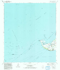
1993 Map of Smith Point
USGS Topo · Published 1994About this map
Smith Point occupies the tip of a prominent peninsula where the waters of Trinity Bay, Galveston Bay, and East Bay converge. This coastal landscape is defined by its industrial and maritime infrastructure, featuring an extensive Oil Field network and the Umbrella Point Oil Field to the north. A maze of Pipeline corridors and offshore platforms illustrates the region's mid-century petroleum development, while the Trinity River Channel and Frankland Pass manage the vital shipping traffic through the bays.
Find a feature on this map
28 named features on this map. Tap any name to fly to it.
Don’t see what you’re looking for? This feature index may not catch every label — zoom into the map to look around manually.
Map Details
Editions of this 1993 Smith Point Map
This is the sole edition of this map. No revisions or reprints were ever made.
Other maps of this area

1916 · Morgan Point
USGS Topo · 1:24,000

1919 · Morgan Point
USGS Topo · 1:31,680

1929 · Texas City
USGS Topo · 1:24,000

1931 · Flake
USGS Topo · 1:24,000

1932 · Clifton By The Sea
USGS Topo · 1:31,680

1932 · Texas City
USGS Topo · 1:31,680

1932 · Bolivar Point
USGS Topo · 1:24,000

1933 · Whites Lake
USGS Topo · 1:31,680

1933 · Smith Point
USGS Topo · 1:31,680

1933 · Bolivar Point
USGS Topo · 1:31,680