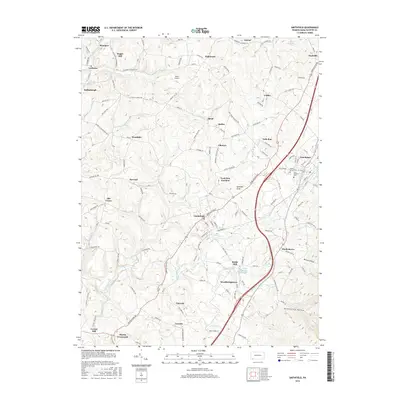
2016 Map of Smithfield
USGS Topo · Published 2016About this map
Smithfield sits at a crossroads of commerce and local transit in Fayette County, where the historic Morgantown Rd meets a network of township routes. This landscape is shaped by the winding paths of Georges Creek and Mountain Cr, which once powered early local industry. Traces of this industrial past are visible at Ruble Mill, located just north of Woodbridgetown. The map reveals a dense settlement pattern of small communities like Shoaf, Smiley, and York Run Junction, many of which developed alongside the coal and coke works that formerly defined the region.
Find a feature on this map
154 named features on this map. Tap any name to fly to it.
Don’t see what you’re looking for? This feature index may not catch every label — zoom into the map to look around manually.
Map Details
Editions of this 2016 Smithfield Map
This is the sole edition of this map. No revisions or reprints were ever made.
Other maps of this area

1900 · Uniontown
USGS Topo · 1:62,500

1900 · Masontown
USGS Topo · 1:62,500

1902 · Morgantown
USGS Topo · 1:62,500

1903 · Masontown
USGS Topo · 1:62,500

1904 · Bruceton
USGS Topo · 1:62,500

1925 · Morgantown
USGS Topo · 1:62,500

1926 · Bruceton
USGS Topo · 1:62,500

1931 · Uniontown
USGS Topo · 1:62,500

1931 · Masontown
USGS Topo · 1:62,500

1931 · Bruceton Mills
USGS Topo · 1:62,500