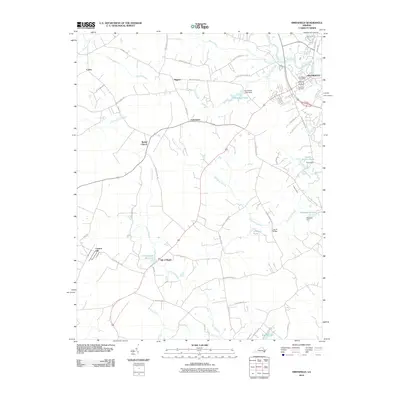
2010 Map of Smithfield
USGS Topo · Published 2010About this map
Smithfield and its adjacent rural landscape are defined by the winding course of the Pagan River and an intricate network of wetlands in the early 21st century. The map illustrates a transition from the historic town center, anchored by the Smithfield Post Office and Evergreen Cemetery, to a hinterland punctuated by small communities like Magnet, Comet, and Foursquare. The reliance on water resources is evident in the numerous ponds and swamps that dominate the terrain, including Courthouse Millpond, Allmond Pond, and Champion Swamp. These features, along with the numerous dams such as Echo Dam and Edwards Dam, reveal a landscape shaped by both natural drainage and human modification. Local genealogy is reflected in named landmarks like Bethel Church and Carroll Bridge, providing specific points of reference for researchers tracing the development of Isle of Wight and its surrounding countryside.
Find a feature on this map
61 named features on this map. Tap any name to fly to it.
Don’t see what you’re looking for? This feature index may not catch every label — zoom into the map to look around manually.
Map Details
Editions of this 2010 Smithfield Map
This is the sole edition of this map. No revisions or reprints were ever made.
Other maps of this area

1907 · Yorktown
USGS Topo · 1:62,500

1919 · Smithfield
USGS Topo · 1:62,500

1919 · Surry
USGS Topo · 1:62,500

1920 · Ivor
USGS Topo · 1:62,500

1943 · Yorktown
USGS Topo · 1:62,500

1943 · Richmond
USGS Topo · 1:250,000

1944 · Windsor
USGS Topo · 1:31,680

1944 · Smithfield
USGS Topo · 1:24,000

1944 · Raynor
USGS Topo · 1:24,000

1944 · Zuni
USGS Topo · 1:24,000