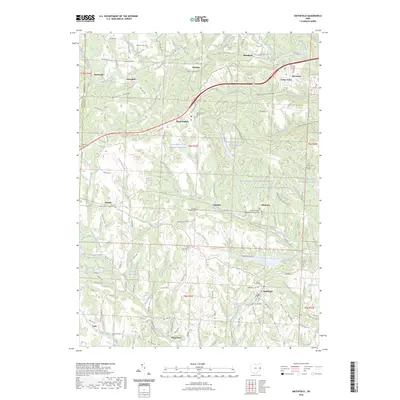
2023 Map of Smithfield
USGS Topo · Published 2023About this map
Smithfield serves as a focal point for this section of Jefferson County, where the village is situated atop the elevated terrain of Warren Ridge. The landscape is defined by its industrial legacy and traditional rural infrastructure, with several expansive water bodies like Boich Mining Company Pond Number One and Consolidation Coal Company Pond 0206 indicating the area's history of coal resource extraction. These industrial sites are interspersed with small communities such as Bloomingdale and Unionport, linked by a network of township roads and creeks including McIntyre Creek.
Find a feature on this map
131 named features on this map. Tap any name to fly to it.
Don’t see what you’re looking for? This feature index may not catch every label — zoom into the map to look around manually.
Map Details
Editions of this 2023 Smithfield Map
This is the sole edition of this map. No revisions or reprints were ever made.
Other maps of this area

1901 · Cadiz
USGS Topo · 1:62,500

1902 · Wheeling
USGS Topo · 1:62,500

1903 · Cadiz
USGS Topo · 1:62,500

1904 · Steubenville
USGS Topo · 1:62,500

1905 · St. Clairsville
USGS Topo · 1:62,500

1935 · Wheeling
USGS Topo · 1:62,500

1935 · Steubenville
USGS Topo · 1:62,500

1942 · Wheeling
USGS Topo · 1:62,500

1942 · Steubenville
USGS Topo · 1:62,500

1951 · Canton
USGS Topo · 1:250,000