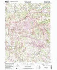
1997 Map of Smithfield
USGS Topo · Published 2000About this map
Extensive industrial activity defines the character of the Smithfield quadrangle in Jefferson County, where numerous Strip Mines and quarries carve through the dissected plateau of eastern Ohio. The Penn Central railroad corridors follow the winding valley of Cross Creek, connecting small settlements like Unionport and Fairplay to the broader regional economy. This landscape is a patchwork of conservation and industry, with the protected acreage of the Fernwood State Forest standing in contrast to the heavily worked land nearby.
Find a feature on this map
54 named features on this map. Tap any name to fly to it.
Don’t see what you’re looking for? This feature index may not catch every label — zoom into the map to look around manually.
Map Details
Editions of this 1997 Smithfield Map
This is the sole edition of this map. No revisions or reprints were ever made.
Other maps of this area

1901 · Cadiz
USGS Topo · 1:62,500

1902 · Wheeling
USGS Topo · 1:62,500

1903 · Cadiz
USGS Topo · 1:62,500

1904 · Steubenville
USGS Topo · 1:62,500

1905 · St. Clairsville
USGS Topo · 1:62,500

1935 · Wheeling
USGS Topo · 1:62,500

1935 · Steubenville
USGS Topo · 1:62,500

1942 · Wheeling
USGS Topo · 1:62,500

1942 · Steubenville
USGS Topo · 1:62,500

1951 · Canton
USGS Topo · 1:250,000