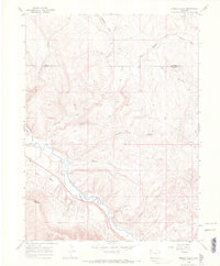
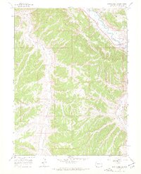
1966 Map of Smizer Gulch
USGS Topo · Published 1969About this map
The White River carves a winding path through this corner of Northwest Colorado, providing the primary water source for an arid landscape of high mesas and deep gulches. Agriculture and early water management are evident in the Blair Ditch, which skirts the base of Blair Mesa near the foot of Blair Mountain. The topography is defined by a dense network of drainage systems, including Smizer Gulch, Crooked Wash, and Mc Andrews Gulch, which illustrate the complex erosional patterns of the Rio Blanco and Moffat county line.
Find a feature on this map
20 named features on this map. Tap any name to fly to it.
Don’t see what you’re looking for? This feature index may not catch every label — zoom into the map to look around manually.
Map Details
Editions of this 1966 Smizer Gulch Map
3 editions found
Other maps of this area

1907 · White River
USGS Topo · 1:125,000

1910 · White River
USGS Topo · 1:125,000

1954 · Vernal
USGS Topo · 1:250,000

1958 · Vernal
USGS Topo · 1:250,000

1958 · Citadel Plateau
USGS Topo · 1:62,500

1960 · Vernal
USGS Topo · 1:250,000

1960 · Elk Springs
USGS Topo · 1:62,500
1966 · Smizer Gulch
USGS Topo · 1:24,000
1966 · White River City
USGS Topo · 1:24,000
1966 · Barcus Creek SE
USGS Topo · 1:24,000