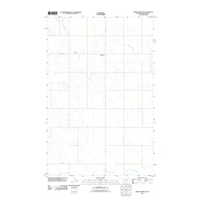
2011 Map of Smoke Creek SW
USGS Topo · Published 2011About this map
Zion Cemetery sits at a remote section of Anderson Rd in this northern Roosevelt County landscape, documented by the U.S. Geological Survey in 2011. The area is characterized by a high-plains drainage network, with the headwaters of Lake Creek cutting through the southeast corner. The small settlement of Anderson is situated along Brockton Rd, also identified as Fas 344, which serves as a primary north-south artery for local ranching and agricultural transport. Further north, the Froid Hwy crosses the plains, connecting this isolated part of the Brockton District with neighboring townships. This map offers a precise look at the 21st-century road grid, including Lawson Rd, during a period of modern land management in northeastern Montana.
Find a feature on this map
8 named features on this map. Tap any name to fly to it.
Don’t see what you’re looking for? This feature index may not catch every label — zoom into the map to look around manually.
Map Details
Editions of this 2011 Smoke Creek SW Map
This is the sole edition of this map. No revisions or reprints were ever made.
Other maps of this area

1909 · Smoke Creek
USGS Topo · 1:62,500

1912 · Hay Creek
USGS Topo · 1:62,500

1912 · Poplar
USGS Topo · 1:62,500

1912 · Smoke Creek
USGS Topo · 1:62,500

1914 · Brockton
USGS Topo · 1:62,500

1950 · Coyote Coulee
USGS Topo · 1:24,000

1950 · Calais
USGS Topo · 1:24,000

1954 · Wolf Point
USGS Topo · 1:250,000

1958 · Wolf Point
USGS Topo · 1:250,000

1972 · Poplar NE
USGS Topo · 1:24,000