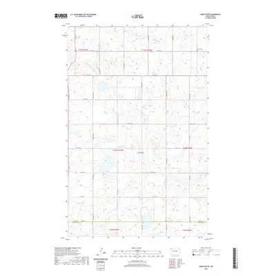
2020 Map of Smoky Butte
USGS Topo · Published 2020About this map
Smoky Butte rises as a prominent landmark in this corner of the northern plains, where the border between Divide Co and Williams Co meets. The landscape is defined by the prairie pothole region's characteristic wetlands and depressions, with Holm Lake situated in the southern portion of the quadrangle. This 2020 survey illustrates a sparsely populated agricultural environment organized by a strict cardinal grid of rural routes, including 136th Ave and 87th St NW. Cultural markers are few but significant for local history, notably the Herman Cem located in the northeastern section. The map serves as a contemporary record of land divisions and township boundaries, such as t160n r100w, showing how long-established surveying lines continue to dictate the modern geography of these North Dakota counties.
Find a feature on this map
27 named features on this map. Tap any name to fly to it.
Don’t see what you’re looking for? This feature index may not catch every label — zoom into the map to look around manually.
Map Details
Editions of this 2020 Smoky Butte Map
This is the sole edition of this map. No revisions or reprints were ever made.
Other maps of this area

1948 · Smoky Butte
USGS Topo · 1:24,000

1948 · Crosby SW
USGS Topo · 1:24,000

1948 · Stady
USGS Topo · 1:24,000

1948 · Bright Water Lake
USGS Topo · 1:24,000

1948 · Zahl
USGS Topo · 1:24,000

1950 · Crosby
USGS Topo · 1:62,500

1953 · Williston
USGS Topo · 1:250,000

1957 · Williston
USGS Topo · 1:250,000

1977 · Appam
USGS Topo · 1:24,000

1977 · Alamo
USGS Topo · 1:24,000