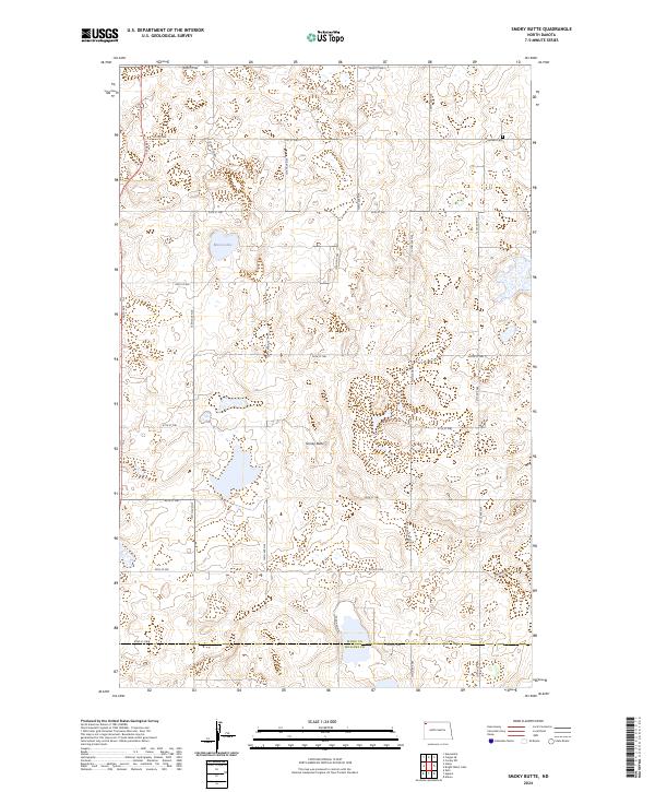
2024 Map of Smoky Butte
USGS Topo · Published 2024About this map
Smoky Butte rises as a prominent landmark in this prairie landscape along the northern edge of the Missouri Plateau. This 2024 survey documents a region characterized by its glacial potholes and conservation lands, most notably the extensive Divide County Waterfowl Production Area which spans multiple sections. Near the northeastern corner, the Herman Cem serves as a quiet genealogical marker of early settlement history in Township 161 North. The map reveals the strictly gridded section lines of the Public Land Survey System, defined by gravel roads such as 136th Ave and 92nd St NW, which navigate around water bodies like Musta Lake. Stretching across the border of Divide and Williams counties, the area remains a sparse, agricultural environment focused on water preservation and land management.
Find a feature on this map
29 named features on this map. Tap any name to fly to it.
Don’t see what you’re looking for? This feature index may not catch every label — zoom into the map to look around manually.
Map Details
Editions of this 2024 Smoky Butte Map
This is the sole edition of this map. No revisions or reprints were ever made.
Other maps of this area

1948 · Smoky Butte
USGS Topo · 1:24,000

1948 · Crosby SW
USGS Topo · 1:24,000

1948 · Stady
USGS Topo · 1:24,000

1948 · Bright Water Lake
USGS Topo · 1:24,000

1948 · Zahl
USGS Topo · 1:24,000

1950 · Crosby
USGS Topo · 1:62,500

1953 · Williston
USGS Topo · 1:250,000

1957 · Williston
USGS Topo · 1:250,000

1977 · Appam
USGS Topo · 1:24,000

1977 · Alamo
USGS Topo · 1:24,000